FOR UP-TO-DATE INFORMATION VISIT THE RFS WEBSITE
IF YOU ARE IN AN EMERGENCY, PLEASE CONTACT 000
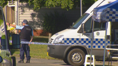
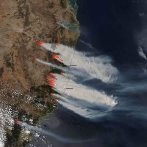
Residents across much of the state are preparing for another horror day of bushfire conditions on Tuesday, with ‘catastrophic’ warnings expected in the Hunter, Greater Sydney, and Illawarra Shoalhaven regions.
“Catastrophic is the highest level of bushfire danger. Homes are not designed to withstand a fire under these conditions,” the RFS said.
If a fire starts and takes hold during catastrophic fire danger conditions, lives and homes will be at risk.

FOR UP-TO-DATE INFORMATION ON FIRES NEAR YOU VISIT THE RFS WEBSITE
Across the Hunter, the Local Government Areas (LGA) of Cessnock, Dungog, Lake Macquarie, Singleton and the Upper Hunter are all under a ‘catastrophic’ warning.
Temperatures on Tuesday will be extremely high, with a dry, southerly change expected in the early evening.
WHAT’S EXPECTED WEATHER WISE?
Information via Bureau of Meteorology
GOSFORD – Expected Max. 37 – Hot. Areas of smoke haze in the early morning. Sunny day. Winds north to northwesterly 30 to 45 km/h ahead of a squally southerly change 45 to 65 km/h in the evening.
NEWCASTLE – Expected Max. 37 – Hot. Areas of smoke haze in the early morning. Sunny day. Winds northwesterly 35 to 55 km/h shifting southerly 40 to 60 km/h in the late evening.
TAMWORTH – Expected Max. 35 – Sunny day. Possible raised dust in the late afternoon and evening. Light winds becoming northwesterly 25 to 40 km/h in the morning then becoming light in the late evening.
MOREE – Expected Max. 38 – Hot. Areas of smoke haze on the slopes. Sunny day. Areas of raised dust in the late afternoon and evening. Winds east to northeasterly 15 to 20 km/h shifting west to northwesterly 25 to 40 km/h during the morning. Overnight temperatures falling to between 11 and 15 with daytime temperatures reaching 33 to 39.
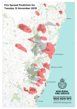
PORT MACQUARIE – Expected Max. 32 – Mostly sunny. Smoky. Winds northerly 15 to 20 km/h becoming light before dawn then becoming north to northeasterly 25 to 35 km/h in the morning.
COFFS HARBOUR – Expected Max. 30 – Mostly sunny. Smoky. Winds northerly 25 to 35 km/h tending northeasterly 20 to 30 km/h in the late afternoon then becoming light in the late evening.
LISMORE – Expected Max. 35 – Mostly sunny. Smoky. Light winds becoming northwesterly 15 to 20 km/h in the morning then tending northerly 20 to 30 km/h in the late afternoon.
Residents are being warned that if fire takes hold on Tuesday, it could be impossible to stop and that homes are likely to be lost.
The advice from the RFS, if your plan is to leave, do so early.
It’s the first time a catastrophic declaration has been made for Sydney under the new rating system, which came into effect 10-years ago.
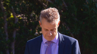
“We’ve got to keep reminding ourselves that catastrophic is off the conventional scale,” said RFS Commissioner Shane Fitzsimmons.
Australia’s worst bushfire tragedy was the Black Saturday fires of February 2009, in which 173 people were killed and more than 3,000 homes were destroyed.
FOR UP-TO-DATE INFORMATION ON FIRES NEAR YOU VISIT THE RFS WEBSITE