
Latest NBN NewsMid North NewsNewcastle News

TRADITIONAL OWNERS EVICTED AHEAD OF BULAHDELAH BYPASS PROJECT

The traditional owners of Alum Mountain at Bulahdelah have clashed with police, after being told to move so the RTA can start clearing land for a highway bypass.
One of the aboriginal elders has applied for an injunction, until an application to protect the land is heard in the Federal Court.
text will be replaced
I am a local from Bulahdelah and have lived here all 18 years of my life, im quite confussed as to what direction i support, at first i was really against as its such a beautiful mountain full of trails an wild life, ive done most of my cross country running up there and the idea of a big strip of the tar through is quite unsettling, but at the same time my father had a great point about all the people that have lost their lives on the current highway, and the horrible burden there family members and friends carry with them, so with the highway i no there is the good of the death rates that will decrease. Whats more important trees lives or our own?
Rachel, there’s an easy win-win solution: move the by-pass to the other side of the town.
I agree with you about how beautiful the mountain is. I was at the mountain park on Monday and the police were being quite racist to uncle worimi and aunty cynthia, telling them that they had come to steal their lands (in those words).
I wonder how people would react if they built a dual-carriageway through a cathedral? That is the equivalent of destroying aboriginal sacred sites for a road.
It’s pretty stunning that Peter Garrett would say that the site is not significant to aboriginal people. why would the elders risk their lives and health protecting the mountain to the extent they are if the site is not significant to them? and who is peter garrett to say what is and isn’t significant to aboriginal elders? It’s time these politicians and RTA learnt a little bit of respect.
Rachel. Yes the Alum Mountain is very beautiful and should remain that way. Aboriginal sites should not be destroyed. I believe a Western Route should be used for the Pacific Highway Upgrade. A Western route would also not have the hazards that Option E has. Here are some of the RTA documented hazaeds for Option E.
Pacific Highway Bulahdelah ‘upgrade’
Hazards of Option E – compilation of RTA documentation
Risks to Drivers and Residents [and passengers and visitors to Bulahdelah]
From the RTA document Bulahdelah Upgrading the Pacific Highway Environmental Impact Statement – Main Volume 8.2.5. Design, Engineering and Constructability:-
There are risks to drivers on the proposed Upgrade, and to residents of Bulahdelah associated with boulders falling from the cliffs and slopes upslope from the proposed Upgrade.
—————————————
From the RTA document Bulahdelah Upgrading the Pacific Highway Environmental Impact Statement – Main Volume 8.2.5. Design, Engineering and Constructability:-
Achievement of Objective [i.e. Objective Failures]
The concept design adheres to the engineering and design criteria in all but three cases. … The three areas where the desirable standards have not been met are:
• at the crest within the large cutting on the footslopes of Bulahdelah ([the]Alum) Mountain, where the vertical alignment criterion has been reduced from 110 kilometres per hour to 100 kilometres per hour. …
• between Bombah Point Road and the mountain access track near Mountain Park.
The new highway would climb at approximately 3 percent over 900 metres, creating speed reductions of approximately 25 kilometres per hour for laden trucks in the northbound direction. …; and
• the median width has been reduced to 11 metres, being the minimum desired median width, to reduce the area of impact in areas of sensitivity.
—————————————
The Existent Landslide
From the RTA document Bulahdelah Upgrading the Pacific Highway Environmental Impact Statement – Volume 6 technical paper 11 – page 3 – 2:-
In areas of the identified colluvium [i.e. the soils, rocks and gravel etc. of the already occurred landslide] where the depth to rock extended to 25 metres, the colluvium comprises a variety of materials, including cobbles and boulders up to 5 metres maximum size in a silty clay and gravel matrix considered to be [i.e. ‘identified’ as being] the remnants of an ancient landslide.
—————————————
Risks of Existent Landslide Collapse
From the RTA document Bulahdelah Upgrading the Pacific Highway Environmental Impact Statement – Main Volume 8.2.5. Design, Engineering and Constructability:-
There are also risks of slope failure of the colluvial material [i.e. the up to 25 metres deep soils, rocks and gravel etc. of the already occurred landslide] during both construction and the operation of the proposal.
—————————————
From the RTA document Bulahdelah Upgrading the Pacific Highway Environmental Impact Statement (EIS) – Volume 3 Technical Paper 6 – Pages A-1 – A-6 – A2 Methodology:-
Studies … show [that] crash rates increase significantly when truck speed reduction exceeds 15 kilometres per hour.
From the EIS – Main Volume 8.2.5. Design, Engineering and Constructability:-
Between Bombah Point Road and the mountain access track near Mountain Park: The new highway would climb at approximately 3 percent over 900 metres, creating speed reductions of approximately 25 kilometres per hour for laden trucks in the northbound direction.
_ _ _ _ _
From the RTA document Bulahdelah Upgrading the Pacific Highway Environmental Impact Statement (EIS) – Volume 3 Technical Paper 4 – 4.3.3 Northern Section (Northern Interchange to Northern End):-
The highway alignment would follow a long sweeping curve (1,750-metre radius) north from the water reservoirs to Frys Creek, crossing just to the western side of the existing highway opposite Bulahdelah Golf Course. The vertical alignment would crest and then grade down at approximately 2.5 percent for 1 kilometre to Frys Creek.
This grade would cause a speed reduction of approximately 20 kilometres per hour for laden southbound trucks. [From the EIS – Volume 3 Technical Paper 6 – Pages A-1 – A-6 – A2 Methodology: Studies … show [that] crash rates increase significantly when truck speed reduction exceeds 15 kilometres per hour.]
_ _ _ _ _
From the RTA document Bulahdelah Upgrading the Pacific Highway Environmental Impact Statement (EIS) – Volume 3 Technical Paper 6 (pages A-1 – A-6), the Option E hill, which would slow northbound laden trucks by approximately 25 km per hour over a distance of 900 metres, should have a northbound climbing lane.
The RTA used the American Association of State Highway and Transportation Officials (AASHTO) – Geometric Design of Highways and Streets for this assessment which, on four counts, concluded ‘a climbing lane is warranted’.
In said referenced documentation the RTA states: ‘AASHTO’s recommendation is based on studies which that show crash rates increase significantly when truck speed reduction exceeds 15 kilometres per hour.’
The RTA, however, made the following determination [added comment in square brackets]: ‘Assessment of the provision of a climbing lane on the western side of the northbound carriageway found that the additional environmental impacts and engineering costs made it less favourable than a third lane within the median over the length of this climb, subject to road safety or traffic records demonstrating a need [i.e. subject to the number of accidents/deaths], some years after opening.’
From EIS Volume 3 Technical Paper 4 4.1 – Engineering Design Criteria for the Concept Design:-
Table 4.2: Typical Cross-section Dimensions for New Highways
Feature Dimension
Four Lane Configuration
Traffic lanes 3.5 metres
Desirable median width (lane line to lane line) 15.0 metres
Minimum median width (lane line to lane line) 11.0 metres
Paved left shoulder 2.5 metres
Paved median shoulder (without safety barrier) 0.5 metres
Six Lane Configuration
Traffic lanes 3.5 metres
Desirable median width (lane line to lane line) 8.0 metres
Minimum median width (lane line to lane line) 4.0 metres
Option E’s median strip width has been reduced from 14 metres (the figure provided by the RTA during the route selection stage – ref. RTA Newsletter 2) to 11 metres.
In 2000, the RTA’s stated expectation was that, in rural areas such as Bulahdelah, dual carriageways would be capable of catering for Pacific Highway traffic volumes for a minimum of 20 years. Option E’s 11 metres of median strip are intended to cater for a future two lanes of traffic volume (a third lane within the median strip for both northbound and southbound traffic). Construction of said two lanes would leave the minimum six lane configuration median width of 4 metres. Being the minimum width, 4 metres is insufficient to provide for a further additional lane within the median.
Even if a climbing lane were to (eventually) be put in place via construction of a third lane within the median strip, as traffic volume increases dictated a need for a third lane of free-flow speed the same as the posted speed limit crash rates would escalate.
I also agree with Jonathan, the display from Police and RTA was absolutely disgraceful.
The term Traditional Owners must be that…owners, and everything to do with their land requires their imprimatur. This should be the case wherever traditional land is subject to interference.
My fullest support goes out to Worimi and all of his supporters. The RTA, Police and Security Guards should be very ashamed of their actions of evicting any Aboriginal Custodian from their own land.
The RTA should be ordered to have some respect, and be ordered to construct their Highway to the WEST of the town. What a total waste of money paying for all of this Security as well. The Tent Embassy members are not the violent ones, they also are not the Racist ones. Maybe the Tent Embassy should apply for this kind of protection, and send the Bill to the RTA and Police.
Despite the title, the following information was not released to the community by the NSW Roads and Traffic Authority (RTA). It, together with the detailed results of geotechnical investigations of the five route ‘options’ revealed to the community, was accidentally handed to a community member on Wednesday, 18th December, 2000.
Geotechnical Issues for Community Information
Table 1 presents a summary of the geotechnical issues relating to each of the five route options. The issues are categorised into eight key headings:
• Bridge/interchange structures (foundations);
• embankments (settlement);
• cuttings (batter slopes and rippability);
• slope stability;
• subgrades (embankments and pavements);
• acid sulfate soils;
• erosion hazard; and
• contaminated soils.
The route options have received a rating for geological issues as described below:
Rating Interpretation
1 Highly unfavourable
2 Unfavourable
3 Neither favourable or unfavourable
4 Favourable
5 Highly favourable
The rating takes into account potential construction and operation problems and the extent and severity of these potential problems [sic] For example, the “Embankments – settlement” item takes into account unfavourable soil conditions, and the likely severity and extent of settlement problems.
The rating also takes into account conditions that may assist construction and provide potential cost savings. For example, under “Cuttings”, rock conditions that assist this process would receive a favourable or highly favourable rating. The scale has been developed for this project but in developing the scale, reference has been made to road building industry norms.
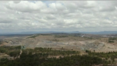
Boulders on [the] Alum Mountain
A small group of Rhyolite irregularly shaped boulders up to 6 metres in diameter was observed at the base of the mid-slopes below and west of the Alum Mountain peak. These rocks are on the eastern edge of the power transmission easement and approximately 50 metres east of the Jackson Street interchange [a long-obsolete central interchange]. These boulders are thought to have originated from the peak of [the] Alum Mountain, directly upslope from their current position. These rocks are an indicator of previous rock face instability, which could potentially impact future route development in this area.
Further examination of Option E will require careful mapping and an assessment of risk of the instability for the cliffs at the peak of [the] Alum Mountain. Risk reduction measures may include cliff stabilisation works, re-alignment of the route and construction of protective mounds.
On page 47 of the Bulahdelah Upgrade of The Pacific Highway Submissions Report Part 1 the RTA states: ‘The RTA is unaware of a document related to this project titled “Geotechnical Issues for Community Information” …’. Yet the RTA continues with: ‘which was dated in early or mid 2002’.
The RTA further states (said reference): ‘… all relevant information identified during the environmental impact assessment is made publicly available, either at appropriate times as the project investigations progress or as part of the Environmental Impact Statement for the project. It is also important to note that the results of the geotechnical investigations for the preferred route as described in Section 3.3.3 of Technical Paper 3 – Need and Route Evaluation indicate that no major geotechnical safety issues were identified on the preferred route.’
In reference to the response by rachel grainger on September 22nd, 2009 9:02 pm:-
That a person stating that she is ‘a local from Bulahdelah’ who has ‘lived here all 18 years of [her] life’ has described the RTA’s Option E as ‘a big strip of the tar through [the Alum Mountain]’ and has also indicated that her father is under the impression that Option E would improve safety for road users shows gross consultation failures on the part of the RTA.
Hardly a ‘strip of tar’, the Option E roadway (which, from the experiences of residents of and near Tyagarah, is likely to be noise-exacerbating random-grooved concrete, not tar) would be located in a blasted-out canyon between 60 and 200 metres wide and up to 25 metres below current ground level through the mountain’s mid-slopes.
The tourism and cultural area which the RTA has now barricaded, including with taxpayer-funded security guards – the Alum Mountain Park and associated heritage areas (which the RTA claimed in Newsletters 3 and 4 would not be affected) – would be completely wiped out.
As the documentation provided by Ben on September 23rd, 2009 2:17 pm shows, Option E is not only unsafe but is positively dangerous.
The RTA’s own records show that Option A (to the near west of the township) is $millions cheaper than Option E (which would cost over $300 million – three hundred million dollars – to complete). The RTA’s own records also show that, based on traffic-flow alone, Option A is the safest of the five route ‘options’ revealed to the general public.
Whatever. How much does “Worimi” claimant want from the people THIS TIME? The whole story is without foundation, and if this is not the case then have the matter tested under Native Title Legislation. This is exactly the same rubbish as Stockton Bight: the real owners will never be properly located. Travesty of justice and rights and abuse of the real owners of 200 years ago.
Tracey you seem very confused. There is no money to be made by Worimi. I suggest you read all of the facts. Trying to protect Sacred Sites does not involve obtaining money in this case. The whole story does have foundation, and if you did your research you would know this. KLALC are the ones who obtained two parcels of land because of its Aboriginal Significance and now sellingthese two parcels of land to the RTA because all of a sudden it has no significance, just one little fact that you seemed to of have missed. Who’s making money Tracey, not Worimi.
Worimi is trying to protect these Sacred Sites for all future generations and at no financial gain what so ever, he almost lost his life in trying to do so, another fact that was not mentioned by Tracey.
Thank you to all of the other people who have posted the real facts here. At least you have taken the time to do some research and provide the dangers and the TRUTH regarding this matter.
Stop Destroying Aboriginal Sites. When this destruction stops so will the Dust Storms and Tsunami’s. Destroying Aboriginal Sites causes other World Wide Destruction. The Alum Sacred Mountain will fight back. The Spirits will decide the final outcome, not the RTA.
To Aboriginal people of genuine cultural beliefs the Alum Mountain (originally named Boolah Dillah) is sacred.
There is documentary evidence that the RTA and Karuah Aboriginal land council executives knew that the mountain was of Aboriginal significance in 1990 when they conducted the environmental impact studies for the Bulahdelah to Coolongolook section of the Pacific Highway Upgrade.
There is also documentary evidence that the RTA and Karuah Aboriginal land council executives were aware of the Aboriginal significance of the mountain during the RTA’s route selection process for the Bulahdelah section of the ‘upgrade’.
Unlike: Karuah Aboriginal land council executives; Great Lakes Council (the latter under the name of MidCoast Water); some others who own/owned parcels of land in the path of the RTA’s Option E; and some who are related to/affiliated with those individuals and organisations, the Aboriginal artist, Worimi, has no pecuniary interest whatsoever.
Aboriginal people of cultural beliefs and knowledge regarding this extensively-documented Aboriginal (and non-Aboriginal) cultural site have been trying to protect it from the RTA’s Option E since the year 2000. As Malcolm posted regarding Worimi’s peaceful and lawful endeavours to protect: ‘he almost lost his life in trying to do so’. As a result of the attempted murders and bashings which took place at the Alum Mountain Park on 28th March, 2009, Worimi had a heart attack and had to have open-heart surgery.
Tracey’s response of ‘Whatever’ to the multitudinous and deadly hazards of Option E displayed callous contempt for human life. It also disregarded the truth in favour of rumour-mongering and ignorance, the same traits utilised by the attempted murderers and their gang to fuel their rage while attacking a gentle man who, like others who have since been assaulted in outbreaks of ‘white’ ‘supremacist’ and other violence at Bulahdelah, is trying to save, not destroy.
I am a supporter of Uncle Worimi at the Bulahdelah Tent Embassy. I see visions and predict the future. I am a prophet. There is no balance anymore between the destroyers of the earth and the guardians of the earth. In revelations 18 it states the destroyers of the earth will be destroyed. Since the eviction of the Bulahdelah Tent Embassy, the day after a dust storm covered NSW and Southern Queensland, we have had the Tsunami and earth quakes and typhoons. This is only going to increase as the RTA bulldoze the trees from the Alum Mountain. There are other things I won’t talk about just yet. I know that all of the workers involved in the Pacific Highway Upgrade – Bulahdelah Section will be taking home the evil with them from their involvement in this mass destruction.
The following has be been copied from a post at the About the Bulahdelah Bypass Facebook group:-
‘The RTA has acknowledged in the Bulahdelah Upgrading the Pacific Highway Environmental Impact Statement (Volume 6 technical paper 11 – page no. 2 – 14) that the RTA was aware that there is an existent landslide in the path of Option E **during the route selection stage**.
The route selection stage for the Pacific Highway Upgrade at Bulahdelah concluded with the RTA’s Value Management Workshop (29th & 30th August, 2000) where ‘Option E’ was chosen to be recommended to the (then) NSW Minister for Roads, Carl Scully.
The NRMA representative at said workshop [the VMW] was Marzi De Santi.’
There’s nothing about the existent landslide in the VMW Report. From this, it looks as though the RTA might have withheld this vital information from VMW attendees.
Correction of RTA propaganda at the Australian Government website
From the Australian Government’s Department of Infrastructure, Transport, Regional Development and Local Government website (accessed September, 2009) [added statements are in square brackets]:-
Pacific Highway – Bulahdelah Bypass [a gross misnomer]
[Note: A bypass is: ‘a road enabling motorists to avoid towns and any other heavy traffic points or any obstruction to easy travel on a main road’ (ref. the Macquarie Dictionary). With the speed limit lowering to100 km per hour at the crest of the Option E hill and the slowing of both northbound and southbound laden trucks – by approximately 25 to 30 km per hour and 20 km per hour over a distance of 900 metres and 1 km respectively – Option E is no bypass!]
Estimated Project Cost: $379,000,000
[In July, 2000, the estimated cost of Option E was $149 million (one hundred and forty nine million dollars) and the estimated cost of the geotechnically easier Option A was $145 million (one hundred and forty five million dollars). (Ref. RTA, PPK Newsletter 2.)]
Project Description
This project will provide a full bypass of Bulahdelah [note: not a bypass at all, let alone a ‘full’ bypass] including a new crossing over the Myall River [in the floodplain downstream of the confluence of the Myall and Crawford Rivers – where a fill area has been continuously sinking for well over 12 months].
The proposed Bulahdelah Bypass [not a bypass] project comprises a new 8.5km four-lane divided highway bypass [not a bypass] … [more propaganda] from about 1.5km south of Booral Road [note: the 1.5 stretch of new highway south of Booral Road – **and its cost** – could be equally utilised for Option A – i.e. 1.5 km of Option A has already been constructed].
Planning approval for the project [planning approval was actually of RTA propaganda] was obtained on 9 July 2007. The scope of the project includes:
• M-class (motorway) standard, 110 km/h speed limit [note: **not** motorway standard and **not** 110 km per hour speed limit. 100 km per hour speed limit at hill crest, an approximately 25 to 30 km per hour slowing of northbound laden trucks over a distance of 900 metres, an approximately 20 km per hour slowing of southbound laden trucks over a distance of 1 kilometre, no climbing lane for northbound laden trucks, no climbing lane for southbound laden trucks, insufficiently wide median strip fails to cater for future climbing lanes together with the two future lanes necessitated by increases in traffic volume] with grade-seperated [sic] interchanges;
• two lanes in each direction allowing for the future addition of a third lane in each direction [note: as above – median strip is of insufficient width to allow for said lanes plus climbing lanes];
• access to the existing Pacific Highway and the township via two grade-seperated [sic] interchanges;
• new twin bridges over the [subsiding floodplain area of the] Myall River; and
• separation of local and through traffic by use of the existing highway [note: as an access road] with some diversion for local traffic [note: the residential street where the hospital and nursing home are located, Crawford Street, would also be utilised as a highway access road].
Benefits [paragraphs added]
The Pacific Highway is part of the National Land Transport Network between Sydney and Brisbane and is a major corridor for freight, business and tourism travel. [But the RTA intends to spend over to well over $300 million (three hundred million dollars) of Australian Government funding in constructing an anti-freight, anti-business bottleneck through the only tourism venue within Bulahdelah.]
Currently the highway passes through Bulahdelah and divides the town. There is substantial conflict between local and through traffic with high levels of congestion at holiday times. [Note: Option E would bottleneck.]
This section of the Pacific Highway has experienced substantial growth in traffic volumes in recent years and has an unsatisfactory safety record. [Note: the RTA’s own records show Option E to be extremely dangerous (ref. the Bulahdelah Upgrading the Pacific Highway Environmental Impact Statement). The RTA’s own records show that, based on traffic flow alone, Option A is the safest route for road users (ref. the Value Management Workshop Report.]
This project will improve road safety [note: the RTA’s own documentation shows Option E to be extremely dangerous], reduce travel times and operating costs for road users [note: the RTA’s own documentation shows that, due to speed limitations and lack of climbing lanes, Option E fails to reduce travel times and operating costs] and reduce highway maintenance costs.
Bulahdelah Bypass [not a bypass] will [not] improve safety and amenity for the Bulahdelah community. [Note: from the RTA document Bulahdelah Upgrading the Pacific Highway Environmental Impact Statement – Main Volume 8.2.5. Design, Engineering and Constructability – There are risks to drivers on the proposed Upgrade, and to residents of Bulahdelah associated with boulders falling from the cliffs and slopes upslope from the proposed Upgrade; the destruction of the only tourism attraction and cultural and heritage area within Bulahdelah does not ‘improve amenity’.]
The Seven headed beast that has been exposed are the phoney Zionest. The ten horns that break away from the beast that will hate the beast and burn the beast and leave it desolate, could be the countries that were left broke and destitute by the World Trade collapse, or it could be the Indigenous People and their sympathisers who acknowledge the Genosidal War being waged against them. or it could be both.
For example, certain polititions, certain Police, Certain White Supremist, Certain Mafia’s and Certain Snake Headed stand over Indigenous Members of this so called community who are all involved and are puppets for this beast. My predictions next year are the price of gold will fall, a third of the earth will burn a third of the sea will die and world wide Tsumamis, I only know how to open the doors, I do not know how to close them, that job is up to the good people of the World.
Stop destroying Aboriginal Sites, listen to the Elders. Destruction of Aboriginal Sites are causing these World Wide disasters.
A sudden cluster of massive earthquakes which has shaken Asia-Pacific communities and likely left thousands dead has also jolted some scientists, who are starting to question conventional thought.
Experts who dismissed notions that far-away quakes could be linked are beginning to think again after huge tremors rocked Samoa and Indonesia on the same day, followed by another major convulsion in Vanuatu.
Some 184 people died in the terrifying tsunami which smashed Samoa, American Samoa and Tonga on September 30, while thousands are feared dead after parts of Indonesia’s Padang city were reduced to rubble just hours later.
On Thursday, thousands of panicked people fled the coast as a rapid succession of large quakes off Vanuatu set off a tsunami warning for much of the South Pacific.
The day that the Aboriginal Tent Embassy was evicted a heavy downpour of rain happened. The next day a dust storm occurred.
Two days later the RTA started to clear trees. The next day a dust storm occured.
Three days ago the RTA destroyed the Healing Stream. For the last two days dust storms have occurred.
The more Aboriginal sites that are destroyed the more dust storms earthquakes and Tsumamis will occurr.
I have no affiliation with any group in this matter but feel that the RTA have, as usual, treated the people of Bulahdelah with utter contempt.
Aside from the cultural and environmental disaster which the RTA is undertaking, we are about to lose a tourism goldmine and we are doing very little about it.
The potential of spots like this for tourist dollars is amazing. When will ‘Bulahdelians’ realise they have a goldmine on their doorsteps and promote it as such?
Tourists are about to bypass our town and Alum Mt is one of the things we could use to draw them in. Apathy will see this town go down the toilet. We may as well demolish the pub and supermarket along with the mountain, they’ll be no use to us anyway once they go broke.
you cant blame all the disasters that are occurring on the rta destroying aboriginal sites..it seems you are forgetting about all the pollution and the ozone layer. its all the large cities, cars, factories, and the entire worlds population thats at fault..people need to start waking up and realising we need to start acting not thinking about it..like the government seems to be doing.. turn off the lights during the day..start walking people..there are to many fat people out the..
back to the aboriginals…..
The aboriginals need to stop whinging its not all about them, get over it.
they have too easy and we are suppose to be equal says the government.
if we are equal then we are we still saying sorry to them, why is it that they get more handouts from the government, why is it if you are aboriginal you can do tafe courses for free, why is it when they are living in a mission and they trash their houses the government sends people out to fix it so they can do it again.
that doesnt sound very equal to me.
i cant believe they are whinging over one mountain
THERE ARE MORE IMPORTANT THINGS TO WORRY AND CARE ABOUT, LIKE OUR FAMILYS, FRIENDS AND OUR OWN LIVES
Just let the rta do there job
What Adam failed to mention in his post was that the people surf riding on the back of the ute that were going past the tent embassy to help him, called out racial abuse at the aboriginal people camped there. I was there in the park that day Adam, and the racial abuse that was shouted out at the aboringinal people was abosutely discusting. I was glad to leave Bulahdelah after that but I can assure you Adam I or any other person camping there at that time are no BLACK C***S as your mates shouted out at us.
“Adam”
First thing – you need to learn how to spell before posting on the internet.
Second – you failed to mention how you and your mates were illegally ute surfing past the tent embassy and yelling threats and abuse at the campers.
Third – you also failed to mention that some of the group you were with were involved in the brutal bashings of Tent Embassy campers and visitors before the day you and your buddies were ute surfing and yelling threats – including a death threat – and racial abuse.
As you wrote – “if i rtaliate i can wined up being charged”. If you are the instigator – as you and your buddies were – you can also wind up being charged. And you will!
first of all i was not with these people second of all the tent embassey are illegal wana be activists that bludge off the tax payer and geoff spelling is the least of my worrys , maybe you need to look in to why a bunch of protesters for hire were brought here in the begining , because they were and still arent wanted or welcome !
Adam wrote: ” maybe you need to look in to why a bunch of protesters for hire were brought here in the begining”
I have been around a lot and have never heard of as Adam wrote: ” protesters for hire”.
Who would have the money to finance this? Are they paid on an hourly – daily or weekly rate?
Adam said in his post that all of the tent embassy are illegal (wana) be activists that bludge off the tax payer.
I am a member of the Canberra Aboriginal Tent Embassy Adam and I am not a wanna be or Illegal or a Tax Payer Bludger. Nobody who is a member of any Aboriginal Tent Embassy fits into Adams description. We are all very legal.